Approximate Location Map
Large Map »
Latitude: 54.9215 / 54°55'17"N
Longitude: -3.9375 / 3°56'14"W
OS Eastings: 275922
OS Northings: 560254
OS Grid: NX759602
Mapcode National: GBR 0CYJ.BK
Mapcode Global: WH4W0.HK7G
Plus Code: 9C6RW3C7+J2
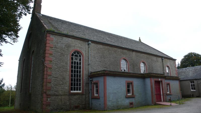
Entry Name: Parish Church And Burial-Ground, Kelton
Listing Name: Kelton Parish Church
Listing Date: 4 November 1971
Category: B
Source: Historic Scotland
Source ID: 342146
Historic Scotland Designation Reference: LB9822
Building Class: Cultural
Also known as: Kelton, Parish Church And Burial-ground
ID on this website: 200342146
Location: Kelton
County: Dumfries and Galloway
Electoral Ward: Dee and Glenkens
Traditional County: Kirkcudbrightshire
Tagged with: Church building Cemetery
External links are from the relevant listing authority and, where applicable, Wikidata. Wikidata IDs may be related buildings as well as this specific building. If you want to add or update a link, you will need to do so by editing the Wikidata entry.


Other nearby listed buildings
