History in Structure

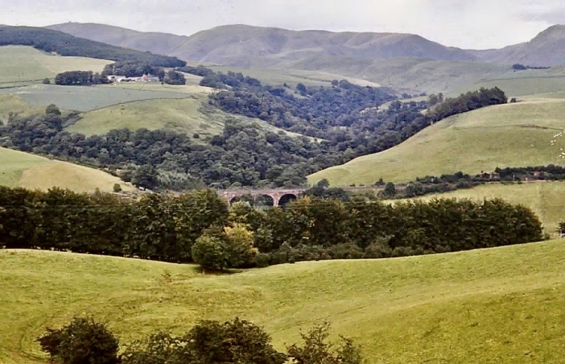
Railway Viaduct, Enterkinfoot

A Category B Listed Building in Durisdeer, Dumfries and Galloway

Enterkinfoot viaduct

Uploader's Comments

Taken in 1979. Trees now almost hide the viaduct when viewed from this road, as shown in Google Street View - https://www.google.com/maps/@55.3155846,-3.8083408,3a,15y,54.59h,82.2t/data=!3m7!1e1!3m5!1skCjNdP1L1kMMtM6RkZvd4A!2e0!6shttps:%2F%2Fstreetviewpixels-pa.googleapis.com%2Fv1%2Fthumbnail%3Fpanoid%3DkCjNdP1L1kMMtM6RkZvd4A%26cb_client%3Dmaps_sv.tactile.gps%26w%3D203%26h%3D100%26yaw%3D44.857212%26pitch%3D0%26thumbfov%3D100!7i16384!8i8192.

Uploaded by John Lawson on 26 February 2022
https://disqus.com/by/disqus_GJm3ATMLxy/

Photo ID: 286985
Building ID: 200335036
Report this photo

Photo Navigator

BritishListedBuildings.co.uk is an independent online resource and is not associated with any government department. All government data published here is used under licence. Please do not contact BritishListedBuildings.co.uk for any queries related to any individual listed building, planning permission related to listed buildings or the listing process itself.

British Listed Buildings is a Good Stuff website.