Approximate Location Map
Large Map »
Latitude: 50.9501 / 50°57'0"N
Longitude: 0.7304 / 0°43'49"E
OS Eastings: 591884
OS Northings: 120294
OS Grid: TQ918202
Mapcode National: GBR QXP.CH5
Mapcode Global: FRA D6FL.LD8
Plus Code: 9F22XP2J+35
Entry Name: The Pump
Listing Date: 11 September 1972
Grade: II
Source: Historic England
Source ID: 1252160
English Heritage Legacy ID: 435098
ID on this website: 101252160
Location: Rye, Rother, East Sussex, TN31
County: East Sussex
District: Rother
Civil Parish: Rye
Built-Up Area: Rye
Traditional County: Sussex
Lieutenancy Area (Ceremonial County): East Sussex
Church of England Parish: Rye
Church of England Diocese: Chichester
Tagged with: Architectural structure
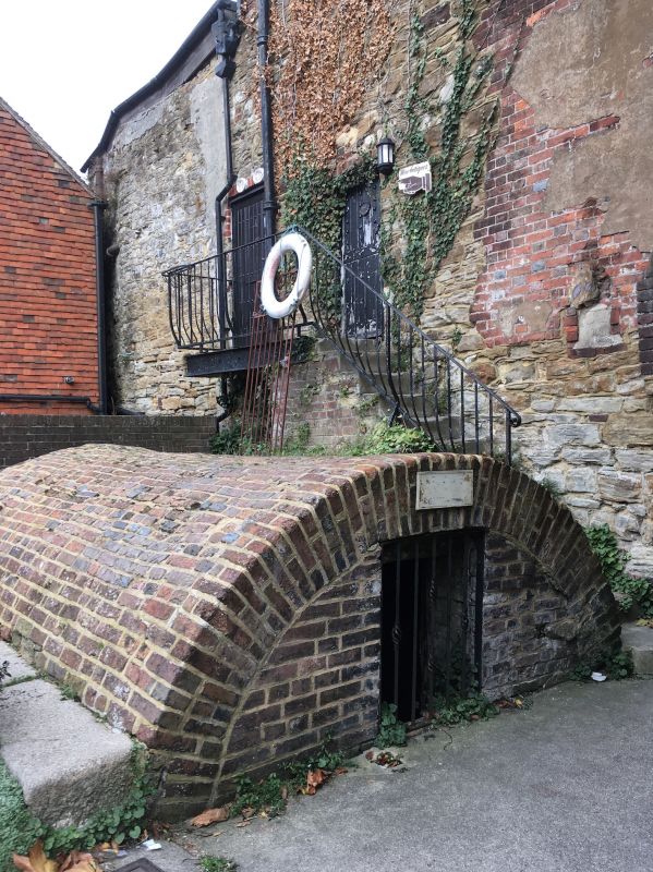
1.
1578 WISH WARD
The Pump
TQ 9120 1/270
II
2.
Late C18 early C19 cast iron hand pump. Arched brick cistern at the rear.
The Town Wall runs behind this property forming the lower part of the wall
of No 54 The Mint qv.
Listing NGR: TQ9188420294
External links are from the relevant listing authority and, where applicable, Wikidata. Wikidata IDs may be related buildings as well as this specific building. If you want to add or update a link, you will need to do so by editing the Wikidata entry.


Other nearby listed buildings
