Approximate Location Map
Large Map »
Latitude: 53.6775 / 53°40'38"N
Longitude: -1.7407 / 1°44'26"W
OS Eastings: 417222
OS Northings: 420145
OS Grid: SE172201
Mapcode National: GBR JT8X.XG
Mapcode Global: WHC9W.7TBM
Plus Code: 9C5WM7G5+XP
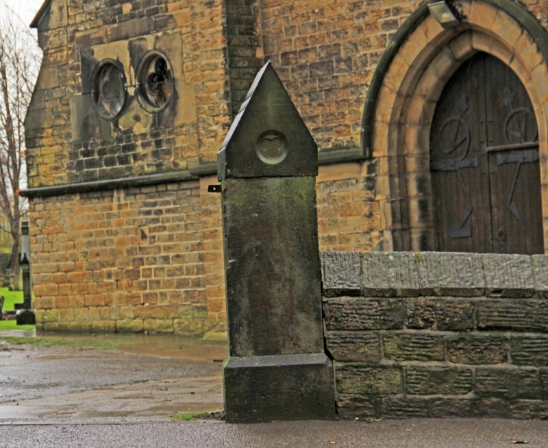
Entry Name: Gatepiers of Church of St Thomas
Listing Date: 26 April 1976
Grade: II
Source: Historic England
Source ID: 1238947
English Heritage Legacy ID: 416591
ID on this website: 101238947
Location: Bradley, Kirklees, West Yorkshire, HD2
County: Kirklees
Electoral Ward/Division: Ashbrow
Parish: Non Civil Parish
Built-Up Area: Huddersfield
Traditional County: Yorkshire
Lieutenancy Area (Ceremonial County): West Yorkshire
Church of England Parish: Bradley St Thomas
Church of England Diocese: Leeds
Tagged with: Gatepost
STATION ROAD
1.
5113
Bradley
Gatepiers of
Church of St Thomas
SE 1720 13/70 26.4.76.
II
2.
Presumably 1863. Ashlar. Pointed tops with geometrical patterae in shallow
relief. Cast iron gates with elaborate ornament.
Listing NGR: SE1722220145
External links are from the relevant listing authority and, where applicable, Wikidata. Wikidata IDs may be related buildings as well as this specific building. If you want to add or update a link, you will need to do so by editing the Wikidata entry.


Other nearby listed buildings
