Approximate Location Map
Large Map »
Latitude: 51.263 / 51°15'46"N
Longitude: 0.3197 / 0°19'10"E
OS Eastings: 561942
OS Northings: 154095
OS Grid: TQ619540
Mapcode National: GBR NPM.PNP
Mapcode Global: VHHPV.HJC4
Plus Code: 9F327879+6V
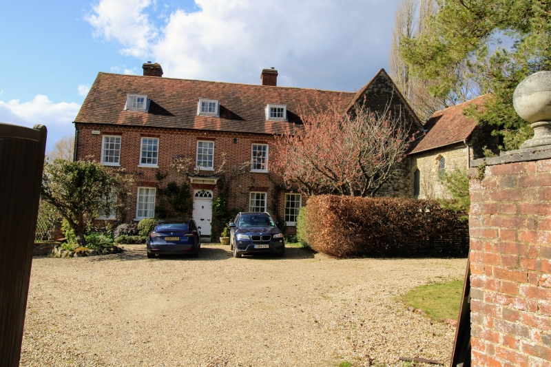
Entry Name: Old Soar Farmhouse
Listing Date: 1 August 1952
Grade: II
Source: Historic England
Source ID: 1072691
English Heritage Legacy ID: 357351
ID on this website: 101072691
Location: Plaxtol, Tonbridge and Malling, Kent, TN15
County: Kent
District: Tonbridge and Malling
Civil Parish: Plaxtol
Traditional County: Kent
Lieutenancy Area (Ceremonial County): Kent
Church of England Parish: Plaxtol
Church of England Diocese: Rochester
Tagged with: Farmhouse
TQ 65 SE PLAXTOL OLD SOAR ROAD
4/22 (north side)
1.8.52 Old Soar Farmhouse
GV
II
Farmhouse. C18, on site of part of, and joined to, Old Soar to right. Red brick.
Corbelled brick eaves to plain tiled roof with 3 small flat-roofed dormers. Two stone
stacks to rear. Two storeys. Five window front, symmetrical glazing bar sashes with
gauged flat arched heads.
Listing NGR: TQ6183653658
External links are from the relevant listing authority and, where applicable, Wikidata. Wikidata IDs may be related buildings as well as this specific building. If you want to add or update a link, you will need to do so by editing the Wikidata entry.


Other nearby listed buildings
