Approximate Location Map
Large Map »
Latitude: 51.3795 / 51°22'46"N
Longitude: 0.2234 / 0°13'24"E
OS Eastings: 554831
OS Northings: 166835
OS Grid: TQ548668
Mapcode National: GBR VM.T5P
Mapcode Global: VHHP6.TLGC
Plus Code: 9F3296HF+Q9
Entry Name: 48-51, High Street
Listing Date: 1 June 1967
Grade: II
Source: Historic England
Source ID: 1237800
English Heritage Legacy ID: 415096
ID on this website: 101237800
Location: Farningham, Sevenoaks, Kent, DA4
County: Kent
District: Sevenoaks
Civil Parish: Farningham
Built-Up Area: Eynsford
Traditional County: Kent
Lieutenancy Area (Ceremonial County): Kent
Church of England Parish: Farningham St Peter and St Paul
Church of England Diocese: Rochester
Tagged with: Building
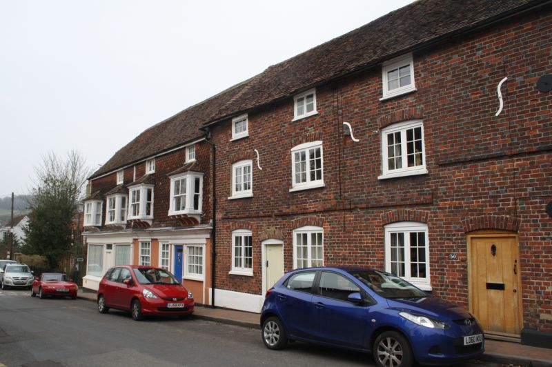
FARNINGHAM HIGH STREET
1.
5280 (north-east side)
TQ 5466 10/107 Nos 48 to 51 (consec)
1.6.67
II
GV
2.
Early C19. Three storeys red brick with grey headers on stuccoed plinth. Old
tiled roof. 3:4:4 casements. S-shaped iron ties. Datestone 1817
TS27
Nos 48 and 49 have joint internal porches.
Listing NGR: TQ5482966839
External links are from the relevant listing authority and, where applicable, Wikidata. Wikidata IDs may be related buildings as well as this specific building. If you want to add or update a link, you will need to do so by editing the Wikidata entry.


Other nearby listed buildings
