
Photos by Scott Engering
I am a geologist with a specialist interest in building stone and historic buildings.
I am a geologist with a specialist interest in building stone and historic buildings.
All Photos: 6306
Photos this month: 10
Photos this week: 10
Featured Photos: 46
Buildings photographed: 2250
First photos of building: 1948
First photos of building this month: 0
First photos of building this week: 0
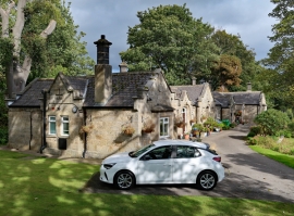
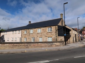
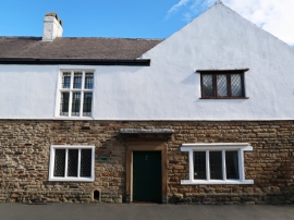
Wadsley Almshouses
An oblique general view of the front (south) elevation.
4 October 2021
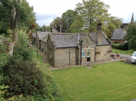
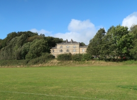
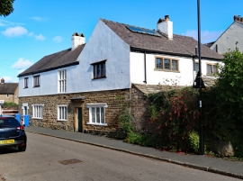
Wadsley Almshouses
A general view from the west.
4 October 2021
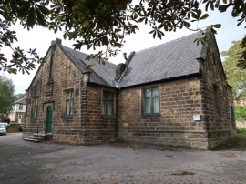
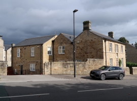
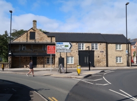
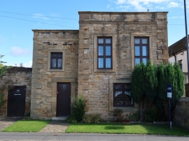
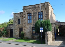
Former Wadsley School Clubhouse
A general view from the south-east.
4 October 2021

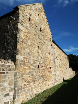
Former Wadsley School Clubhouse
A general view of the north-east elevation.
4 October 2021
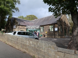
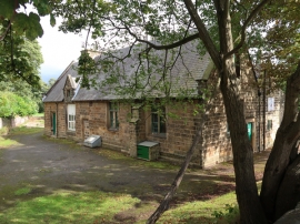
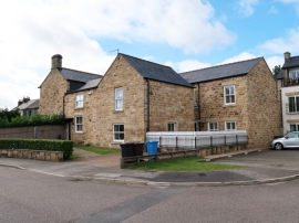
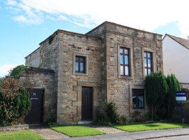
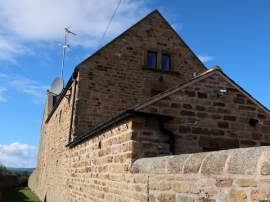
Former Wadsley School Clubhouse
A general view from the south.
4 October 2021
Former Wadsley School Clubhouse
An oblique general view of the north-west elevation.
4 October 2021
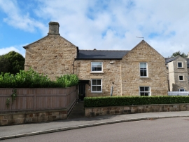
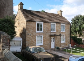
Number 239 and Attached Boundary Wall
A general view from the north.
4 October 2021
Sewer Gas Lamp 15 Metres South of Number 237 (Number 237 Not Included)
A general view.
4 October 2021
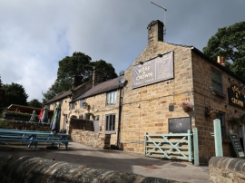
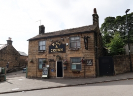
Rose and Crown Public House and Attached Wall
An oblique general view of the south elevation.
4 October 2021
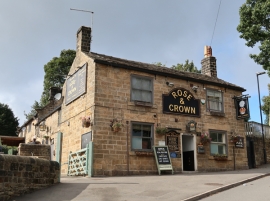
Rose and Crown Public House and Attached Wall
The front (east) elevation.
4 October 2021
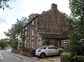
Rose and Crown Public House and Attached Wall
The front (east) elevation.
4 October 2021
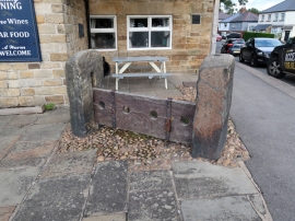
Wadsley Stocks 5 Metres South East of the Wadsley Jack Public House (Public House Not Included)
A general view.
4 October 2021
Loxley House (Royal Navy Training Ship Sheffield) and Adjoining Service Wing
The front (south) elevation.
4 October 2021
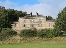
Loxley House (Royal Navy Training Ship Sheffield) and Adjoining Service Wing
A distant view of the front (south) elevation.
4 October 2021
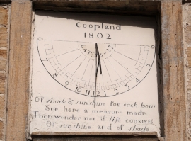
Dial House Club and Attached Boundary Wall
The sundial.
4 October 2021
Dial House Club and Attached Boundary Wall
An oblique general view of the west elevation.
4 October 2021
Dial House Club and Attached Boundary Wall
An oblique general view from the north-east.
4 October 2021
Dial House Club and Attached Boundary Wall
The east elevation.
4 October 2021
Dial House Club and Attached Boundary Wall
The front (south) elevation.
4 October 2021
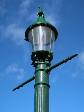
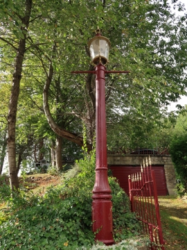
Sewer Gas Lamp at Junction with Portsea Road
A detail.
4 October 2021
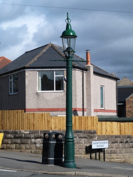
Sewer Gas Lamp at Junction with Portsea Road
A general view.
4 October 2021
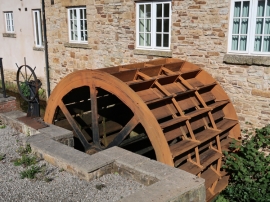
Former Malinbridge Corn Mill
The water wheel.
4 October 2021
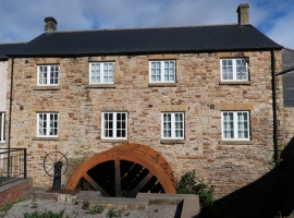
Former Malinbridge Corn Mill
The south elevation and water wheel.
4 October 2021
Former Malinbridge Corn Mill
An oblique general view of the south elevation.
4 October 2021
Former Malinbridge Corn Mill
The east elevation.
4 October 2021
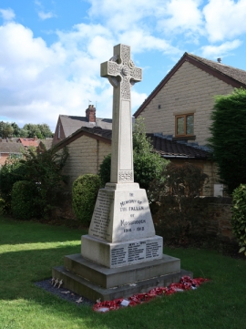
Mosborough War Memorial
A general view from the north-west.
30 September 2021
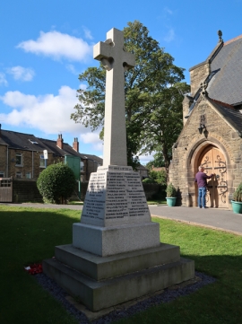
Mosborough War Memorial
A general view from the south-east.
30 September 2021
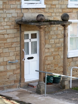
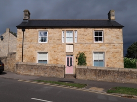
2, Duke Street
The portico.
30 September 2021
2, Duke Street
The front (east) elevation.
30 September 2021
2, Duke Street
An oblique general view of the front (east) elevation.
30 September 2021
31, South Street
A partial view of the rear elevation.
30 September 2021
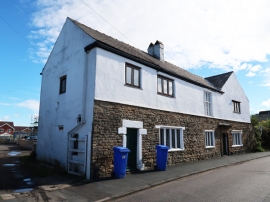
31, South Street
An oblique general view from the north-west.
30 September 2021
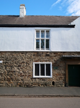
31, South Street
A detail of the west elevation.
30 September 2021
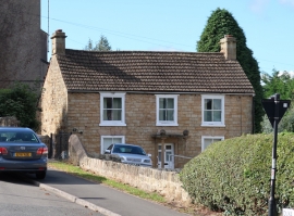
31, South Street
The front (west) elevation.
30 September 2021
31, South Street
An oblique general view from the south-west.
30 September 2021
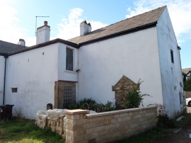
Summerhouse and Attached Garden Wall
The front (west) elevation.
30 September 2021
Summerhouse and Attached Garden Wall
An oblique general view of the front (west) elevation.
30 September 2021
Summerhouse and Attached Garden Wall
An oblique general view of the front (west) elevation.
30 September 2021
Winnowing Barn at Eckington Hall Farm
The east end.
30 September 2021
Winnowing Barn at Eckington Hall Farm
A general view of the south elevation.
30 September 2021