Approximate Location Map
Large Map »
Latitude: 55.8289 / 55°49'44"N
Longitude: -4.5368 / 4°32'12"W
OS Eastings: 241197
OS Northings: 662428
OS Grid: NS411624
Mapcode National: GBR 3F.5V03
Mapcode Global: WH3P4.8RVC
Plus Code: 9C7QRFH7+H7
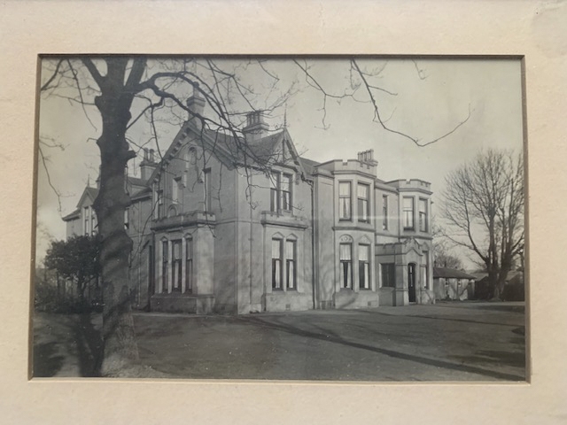
Entry Name: The Elms, Milliken Park Road, Kilbarchan
Listing Name: "The Elms" Milliken Park Road, Kilbarchan.
Listing Date: 19 August 1977
Category: C
Source: Historic Scotland
Source ID: 345756
Historic Scotland Designation Reference: LB12837
Building Class: Cultural
ID on this website: 200345756
Location: Kilbarchan
County: Renfrewshire
Electoral Ward: Johnstone North, Kilbarchan, Howwood and Lochwinnoch
Parish: Kilbarchan
Traditional County: Renfrewshire
Tagged with: Villa
Two-storey villa; stone-built, slated; Victorian Tudor;
battlemented; (probably c.1850-60).
External links are from the relevant listing authority and, where applicable, Wikidata. Wikidata IDs may be related buildings as well as this specific building. If you want to add or update a link, you will need to do so by editing the Wikidata entry.


Other nearby listed buildings
