Approximate Location Map
Large Map »
Latitude: 51.171 / 51°10'15"N
Longitude: 0.7456 / 0°44'44"E
OS Eastings: 592035
OS Northings: 144890
OS Grid: TQ920448
Mapcode National: GBR RWB.HBL
Mapcode Global: VHKKC.WT1P
Plus Code: 9F325PCW+C6
Entry Name: Luckhurst House
Listing Date: 10 October 1980
Grade: II
Source: Historic England
Source ID: 1362685
English Heritage Legacy ID: 181110
ID on this website: 101362685
Location: Pluckley Thorne, Ashford, Kent, TN27
County: Kent
District: Ashford
Civil Parish: Pluckley
Built-Up Area: Pluckley Thorne
Traditional County: Kent
Lieutenancy Area (Ceremonial County): Kent
Tagged with: House
1.
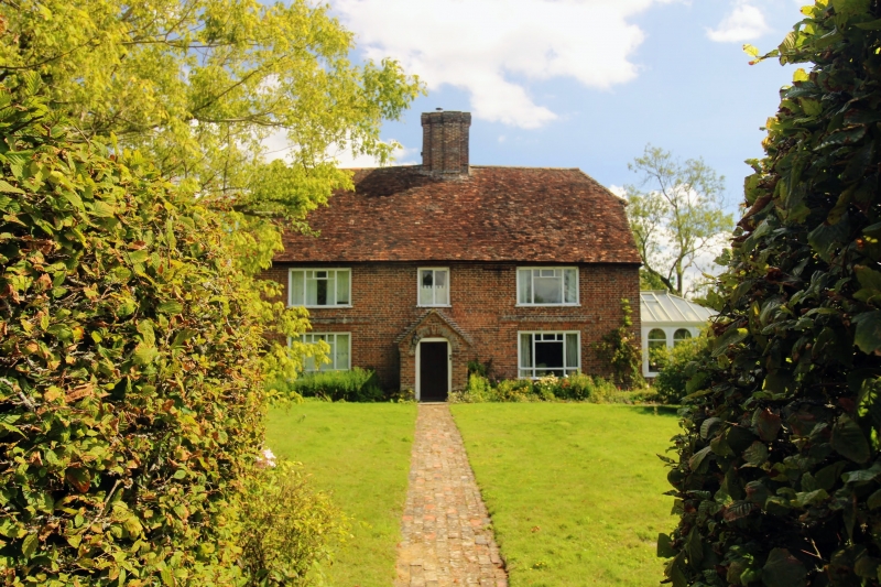
5272 PLUCKLEY SMARDEN ROAD
Pluckley Thorne
Luckhurst House
TQ 94 SW 14/127
II
2.
Cl8. Two storeys and attic in gable end. Red brick. Half-hipped tiled roof.
Three modern casement windows, with brick architraves over these on the ground
floor. Gabled porch.
Listing NGR: TQ9203544890
External links are from the relevant listing authority and, where applicable, Wikidata. Wikidata IDs may be related buildings as well as this specific building. If you want to add or update a link, you will need to do so by editing the Wikidata entry.


Other nearby listed buildings
