Approximate Location Map
Large Map »
Latitude: 52.2973 / 52°17'50"N
Longitude: -0.3882 / 0°23'17"W
OS Eastings: 510011
OS Northings: 267797
OS Grid: TL100677
Mapcode National: GBR H1G.YFW
Mapcode Global: VHFPJ.7J37
Plus Code: 9C4X7JW6+WP
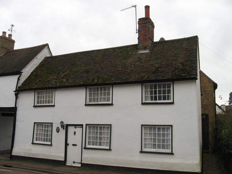
Entry Name: 17, East Street
Listing Date: 28 April 1983
Grade: II
Source: Historic England
Source ID: 1290577
English Heritage Legacy ID: 394882
ID on this website: 101290577
Location: Kimbolton, Huntingdonshire, Cambridgeshire, PE28
County: Cambridgeshire
District: Huntingdonshire
Civil Parish: Kimbolton
Built-Up Area: Kimbolton
Traditional County: Huntingdonshire
Lieutenancy Area (Ceremonial County): Cambridgeshire
Church of England Parish: Kimbolton St Andrew
Church of England Diocese: Ely
Tagged with: Building
KIMBOLTON EAST STREET
TL 095675
(SOUTH-WEST SIDE)
6/29 NO. 17
GV II
Early C19 cottage. Two storeys, roughcast render and painted
brick. Plain tile roof; ridge stack. Three horizontal sliding
sash windows with glazing bars at both floor levels. Modern
door in original frame.
Listing NGR: TL1001167797
External links are from the relevant listing authority and, where applicable, Wikidata. Wikidata IDs may be related buildings as well as this specific building. If you want to add or update a link, you will need to do so by editing the Wikidata entry.


Other nearby listed buildings
