Approximate Location Map
Large Map »
Latitude: 51.0551 / 51°3'18"N
Longitude: 0.3916 / 0°23'29"E
OS Eastings: 567712
OS Northings: 131133
OS Grid: TQ677311
Mapcode National: GBR NS7.XG7
Mapcode Global: FRA C6QB.DD2
Plus Code: 9F32394R+2M
Entry Name: Burnt Lodge
Listing Date: 13 May 1987
Grade: II
Source: Historic England
Source ID: 1274737
English Heritage Legacy ID: 414399
ID on this website: 101274737
Location: Three Leg Cross, Rother, East Sussex, TN5
County: East Sussex
District: Rother
Civil Parish: Ticehurst
Traditional County: Sussex
Lieutenancy Area (Ceremonial County): East Sussex
Church of England Parish: Ticehurst St Mary
Church of England Diocese: Chichester
Tagged with: Gatehouse
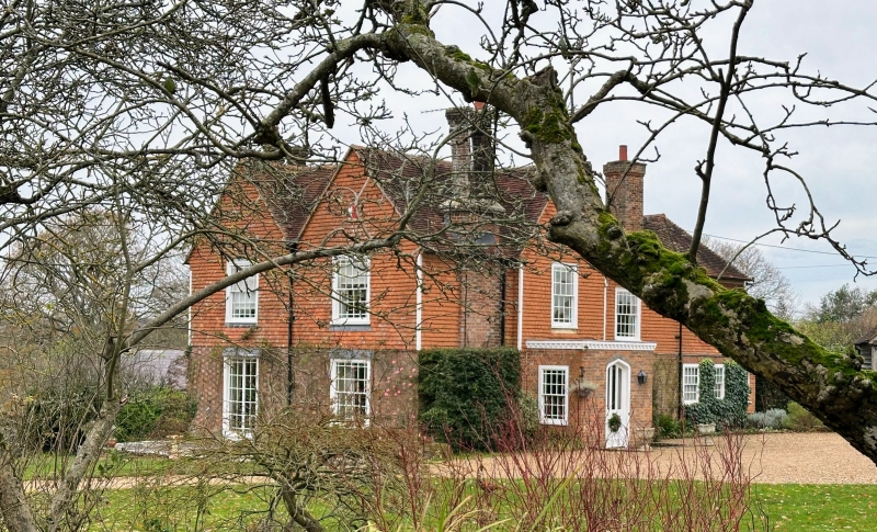
TQ 63 SE TICEHURST BURNT LODGE LANE
1/12 Burnt Lodge
II
On the map called Burnt Lodge Farm. Early C19. Two storeys. Three windows.
Ground floor red brick, above tile-hung. Gable in the centre of front. Tiled
roof. Glazing bars intact.
Listing NGR: TQ6771231133
External links are from the relevant listing authority and, where applicable, Wikidata. Wikidata IDs may be related buildings as well as this specific building. If you want to add or update a link, you will need to do so by editing the Wikidata entry.


Other nearby listed buildings
