Approximate Location Map
Large Map »
Latitude: 52.9461 / 52°56'45"N
Longitude: -1.144 / 1°8'38"W
OS Eastings: 457613
OS Northings: 339084
OS Grid: SK576390
Mapcode National: GBR LQS.F1
Mapcode Global: WHDGZ.D6GT
Plus Code: 9C4WWVW4+C9
Entry Name: Meadow Mill
Listing Date: 29 June 1988
Grade: II
Source: Historic England
Source ID: 1270520
English Heritage Legacy ID: 458506
ID on this website: 101270520
Location: Lace Market, Nottingham, Nottinghamshire, NG2
County: City of Nottingham
Electoral Ward/Division: Bridge
Parish: Non Civil Parish
Built-Up Area: Nottingham
Traditional County: Nottinghamshire
Lieutenancy Area (Ceremonial County): Nottinghamshire
Church of England Parish: Nottingham St George with St John the Baptist
Church of England Diocese: Southwell and Nottingham
Tagged with: Mill
NOTTINGHAM
SK5739SE QUEEN'S ROAD
646-1/24/509 (South side)
29/06/88 Nos.48 AND 50
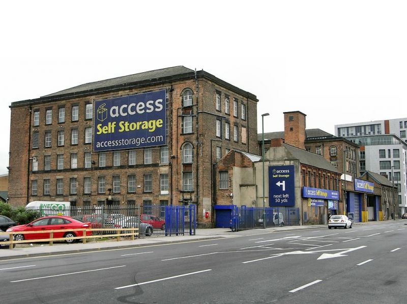
Meadow Mill
II
Cotton spinning mill, later a lace factory, now a warehouse.
c1865. By TC Hine of Nottingham for WE & F Dobson. Altered
late C20. Red brick, with ashlar dressings and hipped slate
roofs. Plinth, and moulded cornice with parapet, concealing a
clerestory roof. Windows are mainly renewed metal framed
casements. 5 storeys plus attics; 30 x 12 windows, U-plan.
Slightly projecting corner bays with round-arched windows.
South front has regular courses of 28 windows, with single
windows in the end bays. Right return has similar regular
fenestration, 11 windows, with blank end bay to left. Left
return has similar fenestration , with an off-centre full
height projection. Rear wings have 4 windows. Rear courtyard
has canted stair turrets in the return angles, and two C20
stair turrets.
(Get to know Nottingham: Brand K: Thomas Chambers Hine ; an
architect of Victorian Nottingham: Nottingham: 14; Industrial
Archaeology of the British Isles: Smith D: The East Midlands:
Dawlish: 1965-: 51).
Listing NGR: SK5761339084
External links are from the relevant listing authority and, where applicable, Wikidata. Wikidata IDs may be related buildings as well as this specific building. If you want to add or update a link, you will need to do so by editing the Wikidata entry.


Other nearby listed buildings
