Approximate Location Map
Large Map »
Latitude: 53.6766 / 53°40'35"N
Longitude: -1.4894 / 1°29'21"W
OS Eastings: 433823
OS Northings: 420140
OS Grid: SE338201
Mapcode National: GBR LT1X.BR
Mapcode Global: WHDC4.3V09
Plus Code: 9C5WMGG6+M6
Entry Name: Chapel of St Mary on East Side of Wakefield Bridge
Listing Date: 14 July 1953
Grade: I
Source: Historic England
Source ID: 1258242
English Heritage Legacy ID: 444626
ID on this website: 101258242
Location: Fall Ings, Wakefield, West Yorkshire, WF1
County: Wakefield
Electoral Ward/Division: Wakefield East
Parish: Non Civil Parish
Built-Up Area: Wakefield
Traditional County: Yorkshire
Lieutenancy Area (Ceremonial County): West Yorkshire
Church of England Parish: Wakefield All Saints
Church of England Diocese: Leeds
Tagged with: Church building
938/6/183 KIRKGATE
14-JUL-53 (South side)
CHAPEL OF ST MARY ON EAST SIDE OF WAKE
FIELD BRIDGE
I
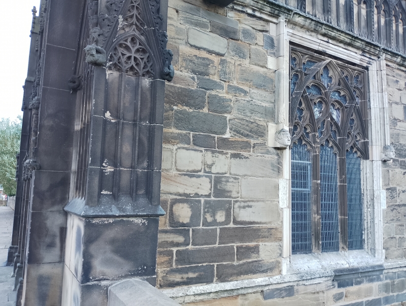
Chapel, projecting to east of central arch, circa 1350. 3-bays, resting on
high, blank undercroft with foundation in the water. Ashlar with parapet of
ogee blank arcading (C19 restoration). Square headed large windows with chamfered reveals, headstopped drip moulds and flamboyant tracery. Octagonal corner pinnacles. West front in reproduction of the decayed original (now at Kettlethorpe Hall, qv). Five narrow bays hold three doors, tmceried panels between, narrow outer sections, Elaborate framing of crocketed ogee arches within ornamented gables. Tall parapet with five relief panels from the lives of Christ and the Virgin. 5-light east window, similar tracery to sides. Interior shows rebuilt roof of old timber, panels with borders and bosses, applied tracery in east bay. Leafy carving on tie beams and tracery above. At north-east corner a small newel staircase. Crocketed spirelet above replaced figure of saint on east wall. Piscina with crocketed ogee head.
Listing NGR: SE3382320140
External links are from the relevant listing authority and, where applicable, Wikidata. Wikidata IDs may be related buildings as well as this specific building. If you want to add or update a link, you will need to do so by editing the Wikidata entry.


Other nearby listed buildings
