Approximate Location Map
Large Map »
Latitude: 50.7027 / 50°42'9"N
Longitude: -2.7273 / 2°43'38"W
OS Eastings: 348733
OS Northings: 89485
OS Grid: SY487894
Mapcode National: GBR PQ.77DQ
Mapcode Global: FRA 5757.38Y
Plus Code: 9C2VP73F+33
Entry Name: 73, High Street
Listing Date: 5 September 1960
Grade: II
Source: Historic England
Source ID: 1214505
English Heritage Legacy ID: 399318
ID on this website: 101214505
Location: Burton Bradstock, Dorset, DT6
County: Dorset
Civil Parish: Burton Bradstock
Built-Up Area: Burton Bradstock
Traditional County: Dorset
Lieutenancy Area (Ceremonial County): Dorset
Church of England Parish: Burton Bradstock and Chilcombe St Mary
Church of England Diocese: Salisbury
Tagged with: Building Thatched cottage
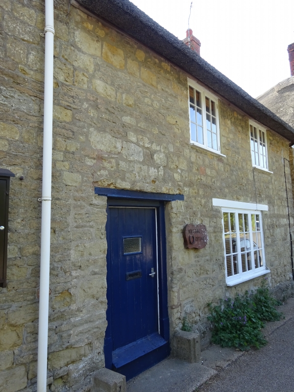
SY 4889 BURTON BRADSTOCK HIGH STREET,
East Side
8/108 No 73
5-9-60
GV II
Attached Cottage. Mid C18. Rubble-stone walls. Thatch roof.
Brick stack at right hand gable. 2 storeys. 2 windows, 2- and
3-light wooden casements with glazing-bars. Wooden cills and
lintels. Plank door, with wood lintel and frame, C20, at left
hand.
Listing NGR: SY4873389485
External links are from the relevant listing authority and, where applicable, Wikidata. Wikidata IDs may be related buildings as well as this specific building. If you want to add or update a link, you will need to do so by editing the Wikidata entry.


Other nearby listed buildings
