Approximate Location Map
Large Map »
Latitude: 50.2709 / 50°16'15"N
Longitude: -4.7874 / 4°47'14"W
OS Eastings: 201467
OS Northings: 44927
OS Grid: SX014449
Mapcode National: GBR ZX.G5TH
Mapcode Global: FRA 08V9.YJ8
Plus Code: 9C2Q76C7+83
Entry Name: Leeside
Listing Date: 11 March 1974
Grade: II
Source: Historic England
Source ID: 1210783
English Heritage Legacy ID: 395365
ID on this website: 101210783
Location: Trevarth Estate, Cornwall, PL26
County: Cornwall
Civil Parish: Mevagissey
Built-Up Area: Mevagissey
Traditional County: Cornwall
Lieutenancy Area (Ceremonial County): Cornwall
Church of England Parish: Mevagissey
Church of England Diocese: Truro
Tagged with: Building
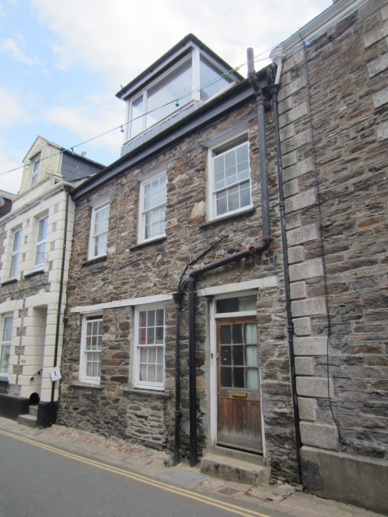
MEVAGISSEY
1. CHURCH STREET
1584A (East Side)
No 13
(Leeside)
SX 04 NW 3/227
II GV
2.
C18. Stone rubble. 2 storeys and attic. 3 sash windows with glazing
bars. Stringcourses at 1st floor and attic levels. Glazed door with rectangular
fanlight. Large modern flat roof dormer. Steep slate roof. Included
for group value.
Nos 1 to 13 (odd) form a group.
Listing NGR: SX0146944928
External links are from the relevant listing authority and, where applicable, Wikidata. Wikidata IDs may be related buildings as well as this specific building. If you want to add or update a link, you will need to do so by editing the Wikidata entry.


Other nearby listed buildings
