Approximate Location Map
Large Map »
Latitude: 50.3498 / 50°20'59"N
Longitude: -4.4664 / 4°27'59"W
OS Eastings: 224626
OS Northings: 52897
OS Grid: SX246528
Mapcode National: GBR NF.WBLD
Mapcode Global: FRA 18J3.PRT
Plus Code: 9C2Q8GXM+WC
Entry Name: Stone Cross at North East Entrance to Village
Listing Date: 17 September 1973
Grade: II
Source: Historic England
Source ID: 1201094
English Heritage Legacy ID: 376359
ID on this website: 101201094
Location: West Looe, Cornwall, PL13
County: Cornwall
Civil Parish: Looe
Built-Up Area: Looe
Traditional County: Cornwall
Lieutenancy Area (Ceremonial County): Cornwall
Church of England Parish: St Martin with St Nicholas, Looe
Church of England Diocese: Truro
Tagged with: Wayside cross
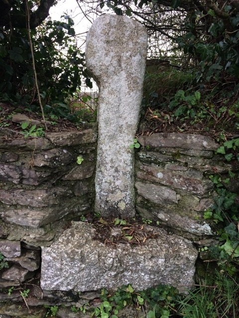
LOOE
SX25SW PORTLOOE
857-1/2/52 Stone Cross at north-east entrance
17/09/73 to Village
II
Wayside preaching cross. Pre-Conquest or Medieval. Small
slender granite monolith with eroded wheel-head and incised
Latin cross to each face.
Listing NGR: SX2462652897
External links are from the relevant listing authority and, where applicable, Wikidata. Wikidata IDs may be related buildings as well as this specific building. If you want to add or update a link, you will need to do so by editing the Wikidata entry.


Other nearby listed buildings
