Approximate Location Map
Large Map »
Latitude: 50.2157 / 50°12'56"N
Longitude: -5.4778 / 5°28'39"W
OS Eastings: 151991
OS Northings: 40867
OS Grid: SW519408
Mapcode National: GBR DXV3.PP0
Mapcode Global: VH12F.0VG0
Plus Code: 9C2P6G8C+7V
Entry Name: Bethesda House
Listing Date: 22 December 1972
Grade: II
Source: Historic England
Source ID: 1143398
English Heritage Legacy ID: 68939
ID on this website: 101143398
Location: St Ives, Cornwall, TR26
County: Cornwall
Civil Parish: St. Ives
Built-Up Area: St Ives
Traditional County: Cornwall
Lieutenancy Area (Ceremonial County): Cornwall
Church of England Parish: St Ives
Church of England Diocese: Truro
Tagged with: House
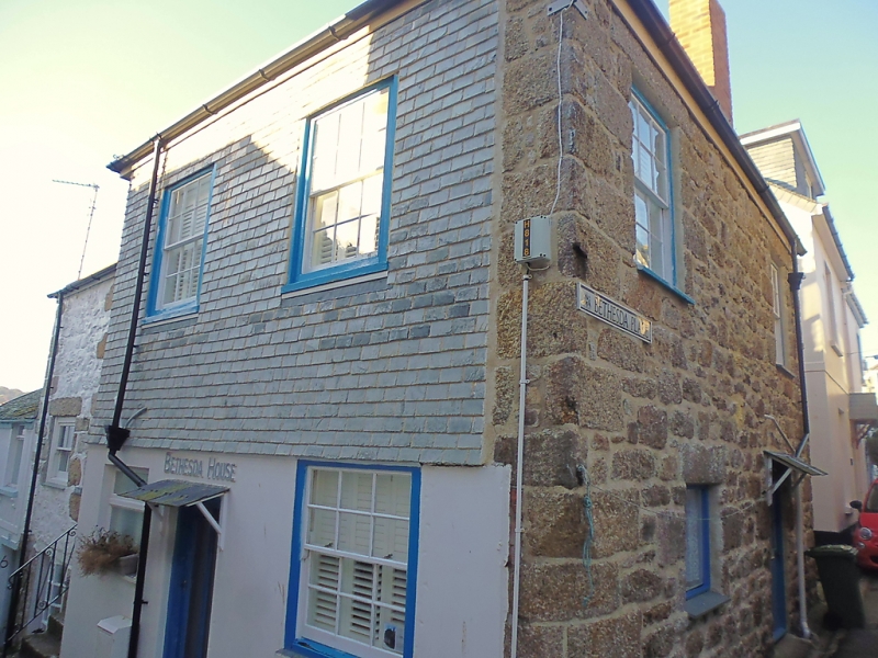
BETHESDA HILL
1. -------------
1587 Bethesda House
SW 54 SW 1/42
II
2.
C18/19. Granite. Stucco ground floor front with slate hanging above.
Two storeys, two windows, sashes with glazing bars, modern ground floor
windows and door. Slurried slate hipped roof.
Listing NGR: SW5199140867
External links are from the relevant listing authority and, where applicable, Wikidata. Wikidata IDs may be related buildings as well as this specific building. If you want to add or update a link, you will need to do so by editing the Wikidata entry.


Other nearby listed buildings
