Approximate Location Map
Large Map »
Latitude: 50.2073 / 50°12'26"N
Longitude: -5.2319 / 5°13'54"W
OS Eastings: 169484
OS Northings: 39142
OS Grid: SW694391
Mapcode National: GBR Z3.G2RC
Mapcode Global: VH12R.81FX
Plus Code: 9C2P6Q49+W6
Entry Name: Milepost Approximately 25 Metres East of Penventon Terrace
Listing Date: 12 September 1989
Grade: II
Source: Historic England
Source ID: 1142625
English Heritage Legacy ID: 66696
ID on this website: 101142625
Location: Four Lanes, Cornwall, TR16
County: Cornwall
Civil Parish: Carn Brea
Traditional County: Cornwall
Lieutenancy Area (Ceremonial County): Cornwall
Church of England Parish: Redruth
Church of England Diocese: Truro
Tagged with: Milestone
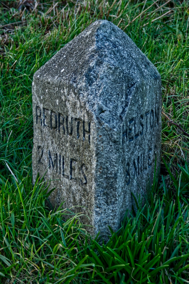
CARN BREA HELSTON ROAD
SW 63 NE
(north side)
8/148 Penventon
Milepost approx. 25 metres
east of Penventon Terrace
II
Milepost. Late C19. Dressed granite. Triangular in section and approx. 1/2 metre
high with triangular top, the side faces inscribed:-
REDRUTH HELSTON
2 MILES 8 MILES
Listing NGR: SW6948439142
External links are from the relevant listing authority and, where applicable, Wikidata. Wikidata IDs may be related buildings as well as this specific building. If you want to add or update a link, you will need to do so by editing the Wikidata entry.


Other nearby listed buildings
