Approximate Location Map
Large Map »
Latitude: 54.2619 / 54°15'42"N
Longitude: -2.7913 / 2°47'28"W
OS Eastings: 348555
OS Northings: 485426
OS Grid: SD485854
Mapcode National: GBR 8MY4.HZ
Mapcode Global: WH838.343L
Plus Code: 9C6V7665+QF
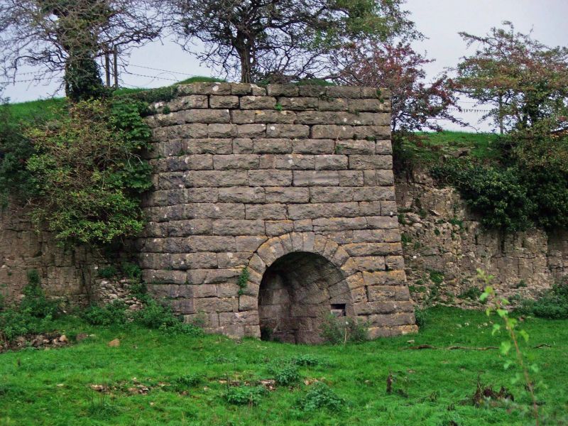
Entry Name: Limekiln
Listing Date: 16 November 1984
Grade: II
Source: Historic England
Source ID: 1081517
English Heritage Legacy ID: 75551
ID on this website: 101081517
Location: Levens, Westmorland and Furness, Cumbria, LA8
County: Cumbria
District: South Lakeland
Civil Parish: Levens
Built-Up Area: Levens
Traditional County: Westmorland
Lieutenancy Area (Ceremonial County): Cumbria
Church of England Parish: Levens St John
Church of England Diocese: Carlisle
Tagged with: Lime kiln
SD 48 NE
1/32
LEVENS
A590 (off) North Side
Limekiln
II
Limekiln. Probably mid C19. Roughly-squared limestone; splayed plinth;
semicircular head to hearth with radiating voussoirs. Top incomplete, but
otherwise very intact. Built into the hillside with retaining walls to either
side: forms a landscape feature.
Listing NGR: SD4855585426
External links are from the relevant listing authority and, where applicable, Wikidata. Wikidata IDs may be related buildings as well as this specific building. If you want to add or update a link, you will need to do so by editing the Wikidata entry.


Other nearby listed buildings
