Approximate Location Map
Large Map »
Latitude: 51.2834 / 51°17'0"N
Longitude: 1.0837 / 1°5'1"E
OS Eastings: 615143
OS Northings: 158323
OS Grid: TR151583
Mapcode National: GBR TY2.JSM
Mapcode Global: VHLGM.Q0SG
Plus Code: 9F3373MM+9F
Entry Name: St John's Board School
Listing Date: 7 September 1973
Grade: II
Source: Historic England
Source ID: 1241918
English Heritage Legacy ID: 441190
ID on this website: 101241918
Location: Northgate, Canterbury, Kent, CT1
County: Kent
District: Canterbury
Electoral Ward/Division: Northgate
Parish: Non Civil Parish
Built-Up Area: Canterbury
Traditional County: Kent
Lieutenancy Area (Ceremonial County): Kent
Tagged with: School building
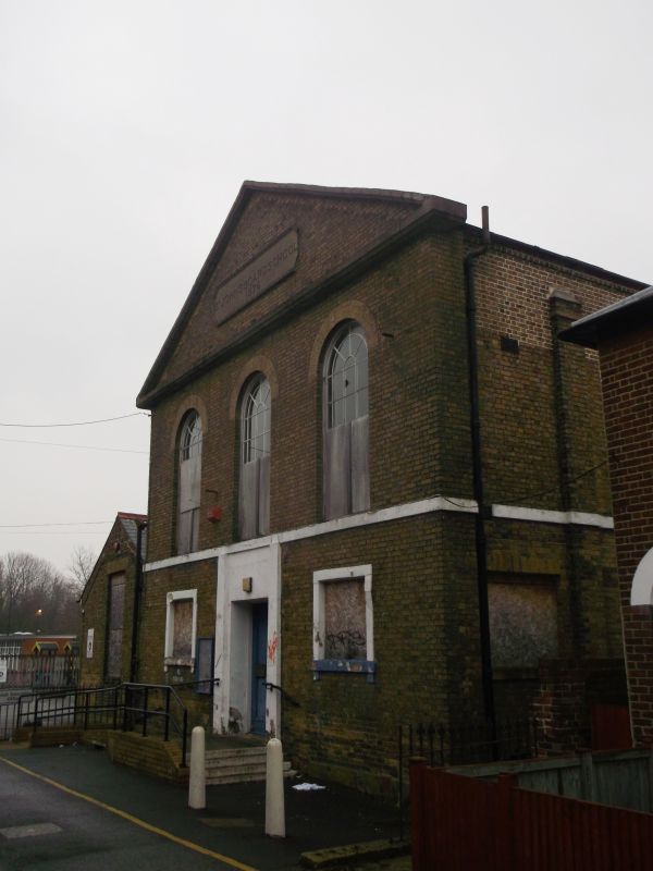
1.
944 ST JOHN'S PLACE
St John's Board School
TR 1558 SW 3/665
II
2.
Dated 1876. 2 storeys buff brick, Pedimented stone dressings, 3 round headed
sashes. Stringcourse. Ground floor has 2 sashes and a doorcase set in a
wide moulded architrave. 3 sashes on side elevation.
Listing NGR: TR1514358323
External links are from the relevant listing authority and, where applicable, Wikidata. Wikidata IDs may be related buildings as well as this specific building. If you want to add or update a link, you will need to do so by editing the Wikidata entry.


Other nearby listed buildings
